Search Results for: “Map”
The History & Records of Queen Victoria's Rifles 1792-1922

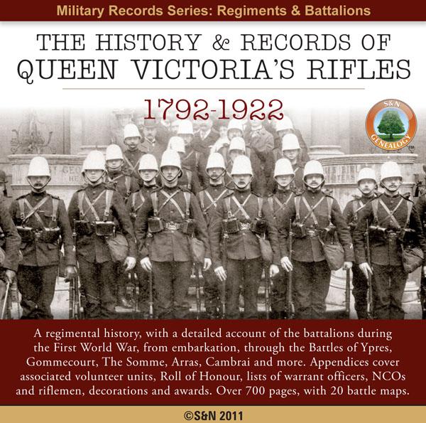
A regimental history, with a detailed account of the battalions during the First World War, from embarkation, through the Battles of Ypres, Gommecourt, The Somme, Arras, Cambrai and more. Appendices cover associated volunteer units, Roll of Honour, lists of warrant officers, NCOs and riflemen, decorations and awards. * Digitally enhanced images of the original text * Searchable text * Bookmarked by major headings * Fully printable * Contains over 700 pages * Includes 20 battle maps... More Info
The History of the Northumberland Fusiliers 1674-1902
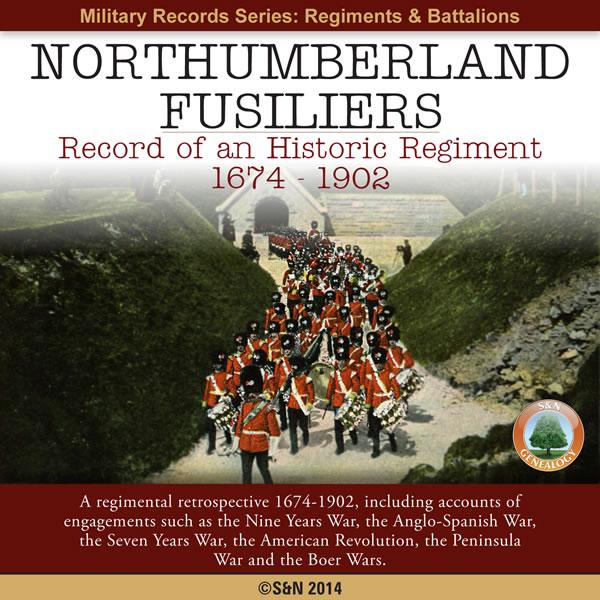
Over 220 years of history is covered in this fascinating CD resource. The Northumberland Fusiliers were part of many campaigns over the years, such as the American Revolution and Anglo-Spanish War. Each chapter of their history is described in detail, and many names are mentioned throughout the text. It also contains maps and illustrations. * Digitally enhanced images of the original text * Searchable text * Bookmarked by major headings * Fully printable * Over 540 pages * Contains maps ... More Info
Product Code: GRD6349
Can't find what you're looking for? Try using our filter system to narrow down your search.
Available through our sister site GenFair
An Historic Map of Wotton-under–Edge


This A4 size coloured map is based on the 1882 Ordnance Survey map of the town at 25 inches to the mile. The map has been annotated with information on some of the historic buildings, people and facts. As well as being of interest in itself it makes an ideal gift when visiting relatives and friends abroad.
Arundel & District 1881 OS Map
Sussex, One Inch to the Mile 1881 Ordnance Survey Map 317. The reverse has a large scale map of Arundel and an article about the area including Chichester, Midhurst and Petworth. Published by Alan Godfrey.
Ashdown Forest and Tunbridge Wells 1894 OS Map
Sussex, One Inch to the Mile 1894 Ordnance Survey Map 303. The reverse has a large scale map of Mayfield and an article about the area including Eridge Park and Piltdown. Published by Alan Godfrey.
Brighton & District 1894 OS Map
Sussex, One Inch to the Mile 1894 Ordnance Survey Map 318. The reverse has a large scale map of Hassocks and an article about the area including Shoreham, Steyning and Henfield. Published by Alan Godfrey.
Haslemere and NW Sussex 1901 OS Map
Sussex, One Inch to the Mile 1901 Ordnance Survey Map 301. The reverse has a large scale map of Cranleigh with Private Residents from a Directory, and an article about this iron and glassmaking area from North Chapel to Petworth and Billingshurst. Published by Alan Godfrey.